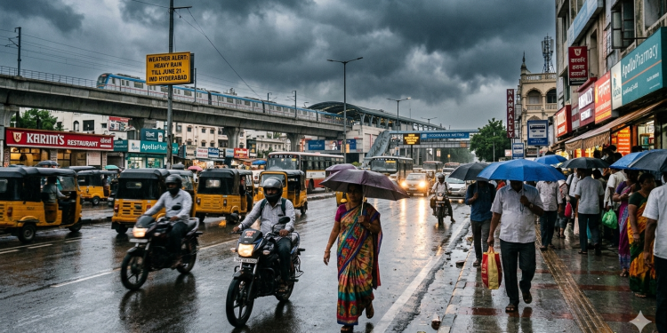
It’s mid-June in Hyderabad, and the weather is playing a game of extreme contrasts. One moment you are trapped in a blistering 40°C afternoon, and the next, a sudden evening thundersquall catches you completely off guard. If you’ve been feeling a bit of weather whiplash lately, brace yourselves—the India Meteorological Department (IMD) Hyderabad has just raised the stakes by issuing a Yellow Alert valid until Sunday, June 21.
Here is everything you need to know about the upcoming rainy spell and why the city is still feeling like a furnace.
The Big Split: Extreme Heat Meets Monsoon Clouds
Despite various districts across Telangana catching sporadic spells of rain over the past few days, the summer heat refuses to back down without a fight. The mercury is stubbornly crossing the 40°C threshold across the state.
According to recent data from the Telangana Development Planning Society (TGDPS):
-
Statewide High: Peddapalli district clocked a scorching maximum temperature of 42.5°C.
-
In the Capital: Within Hyderabad, the Nampally area recorded the city’s highest peak at 37.7°C.
The Southwest Monsoon is actively spreading across the state, its northern boundary cutting straight through Hyderabad. This clash between the incoming monsoon system and the residual summer heat waves is triggering highly unstable weather conditions.
What the Experts are Saying: June 18 to 21 Crucial Window
The state government has already sounded a high-alert warning across administrative machinery, expecting the monsoon to fully lock over the region within the next three to four days. Both official data and local weather experts point to a massive shift later this week.
1. The Official IMD Forecast
The IMD Hyderabad notes that the capital will witness light to moderate rain or thundershowers, accompanied by sudden gusty winds (speeding up to 40–50 kmph), until June 17. However, the intensity shifts heavily from June 18 to June 21, where the state is likely to witness widespread heavy rain, frequent lightning, and intense squalls.
2. The Netizen’s Favorite Forecaster
Popular independent weather enthusiast T. Balaji took to his X (formerly Twitter) handle to back up these projections with his own precise timeline. He shared that Hyderabadis should look out for scattered, localized showers over the next three days. The real action, he promises, starts after June 18, predicting “excellent rain” for the city and tracking intense, heavy thunderstorms heading toward northern and eastern Telangana.
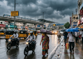
Survival Guide: Plan Your Travel Accordingly
With a Yellow Alert locked in through Sunday, daily commutes are going to get messy. Waterlogging at major bottlenecks like Madhapur, Hitec City, and Khairatabad is almost a given when monsoon storms hit the city.
-
Track Before You Trek: Keep a close eye on real-time traffic apps and localized weather handles before leaving the office.
-
Expect Wind & Lightning: The initial phase of these rains will bring heavy thundersqualls capable of breaking tree branches. Avoid parking under weak structures or old trees.
-
The Travel Buffer: Add an extra 20 to 30 minutes to your travel windows between June 18 and June 21 to navigate potential waterlogging and slow-moving traffic safely.
Keep those umbrellas handy, secure your loose balconies, and enjoy the relief from the heat wave—Hyderabad is officially sliding into peak monsoon mode!